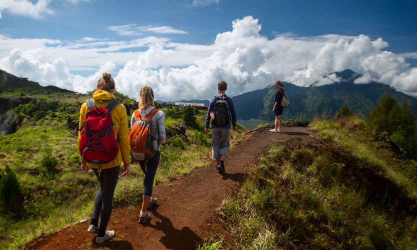
In the central and southern parts of Sri Lanka there are several Mountains and Peaks that are highly ecological and rich in bio diversity. These mountains are preserved as forests and are the starting points of many rivers. The Hill Country is exceptionally beautiful, with crystal clear waterfalls and tea plantations dotted throughout. The temperature in this region stays cool all year round, in an atmosphere of early morning Spring. Everything is green and lush and the landscape is elevated with layers of grass knolls and jagged waterfalls with dense mountain forest clinging to the upper slopes. The days drift by in the hill country with not much to do but drink tea (in abundance) and absorb the serenity and breathtaking walks and views.There are several little towns that are certainly worth a visit, such as Nuwara Eliya. There are also some majestic feats of nature to explore, namely Worlds End and Adams Peak. Worlds End is located in the Horton Plains, which is a rolling highland terrain of grassland interspersed with forest and unusual high-altitude vegetation. The plains reach over 2000 meters high with the mountains of Kirigalpotta and Totapola looming up from the edges of the plateau.The most tremendous feature of the strange silent world of the plains however is Worlds End, where the plains abruptly stop leaving you hovering over a straight drop of 880 meters.
|
Piduruthalagala Mountain
Piduruthalagala Mountain and the Forest Reserve is situated almost next to the heart of Nuwara Eliya Town and Tallest mountain in Sri Lanka. Nuwara Eliya being a mountain valley consists of a plateau that is shaped elliptically. The mountains situated on this plateau rises upto 2000 feet making some ridges. The plateau itself being 6240 feet above sea level makes the highest mountain peak. During 1897, there had been a path made to climb Pidurutalagala mountain. The four mile track to the top could have been made by walking for two and half hours or could be made on horse back. The Ladies of that time also had the choice of being carried on a chair which was tied to two Bamboo poles and carried by four bearers all the way up and back! The British preferred to call this mountain “Pedro” as pronouncing the mountain as “Pidurutalagala” was not an easy task for them. The meaning of word Pidurutalagala can be likened as “ Straw laden rock “. Unlike most mountain peaks found in the world around that has a rocky surface, Pidurutalagala has a flattened mountain peak with pale green patna covering the whole surface as per eyewitness description of 1940. During dry season, this grass may dries up and looks like a mountain top capped with a spread of straw to the distant. There had been only a single man made path to the summit and elsewhere the untouched forest , only with roads that elephants frequented for thousands of years.
|
|
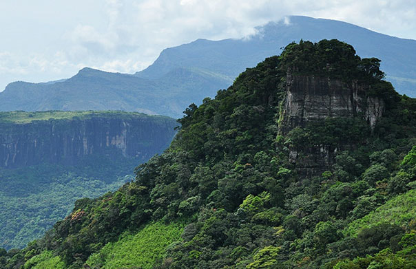
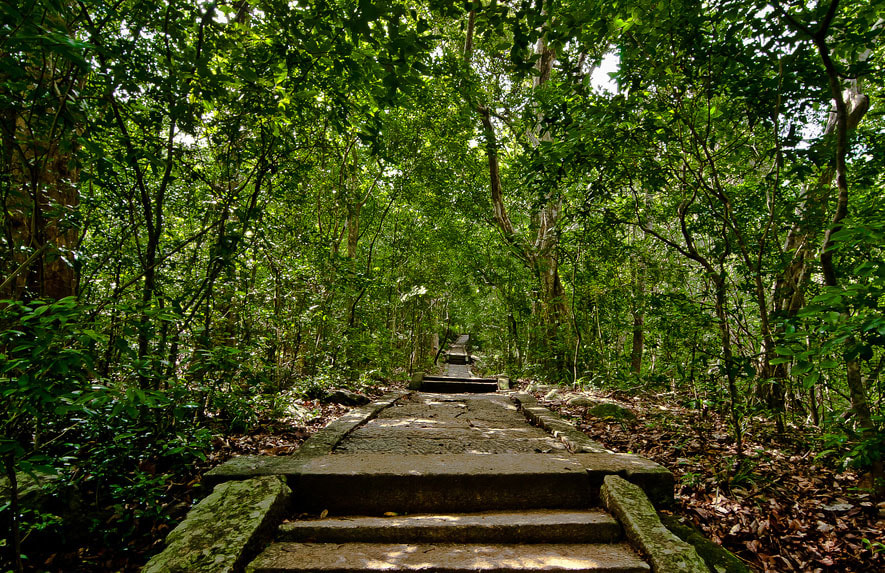
Knuckles Mountain
The Knuckles Mountain Range lies in central Sri Lanka, in the Districts of Matale and Kandy. The range takes its name from a series of recumbent folds and peaks in the west of the massif which resemble the knuckles of clenched fist when viewed from certain locations in the Kandy District. Whilst this name was assigned by earlyBritish surveyors, the Sinhalese residents have traditionally referred to the area as Dumbara Kanduvetiya meaning mist-laden mountain range (Cooray, 1984). The entire area is characterised by its striking landscapes often robed in thick layers of cloud but in addition to its aesthetic value the range is of great scientific interest. It is a climatic microcosm of the rest of Sri Lanka. The conditions of all the climatic zones in the country are exhibited in the massif. At higher elevations there is a series of isolated cloud forests, harboring a variety of flora and fauna, some of which cannot be found anywhere else in the world. Although the range constitutes approximately 0.03% of the island’s total area it is home to a significantly higher proportion of the country’s biodiversity. The visitor needs to make an effort along unfrequented roads to visit the Knuckles Range. Motoring Routes via Loolwatte, Corbet's Gap, Bambarella and Laggala will take you to different spectacular areas of the mountain range.
|
|
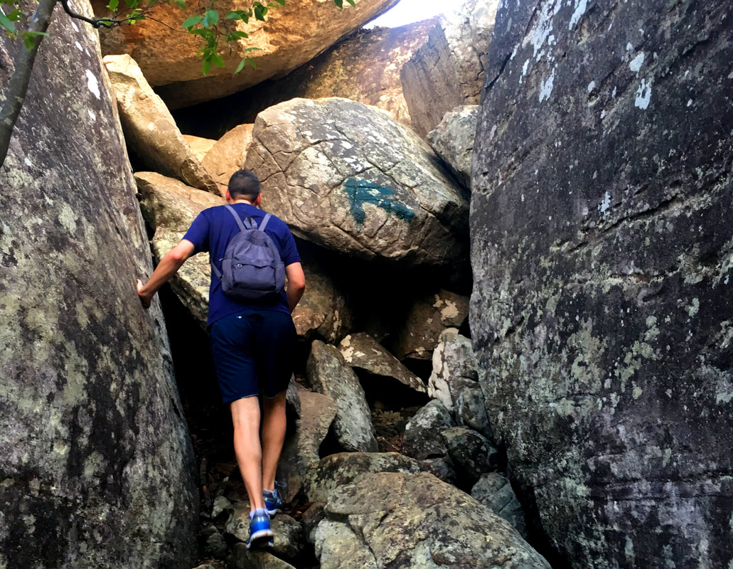
Ritigala Mountain
Ritigala can be reached from the turn-off from Habarana- Anuradhapura Road at a distance of 12km from Habarana. Another 5 km along a graveled yet motorable road leads to the foot of the mountain. Ritigala Mountain at a height of 766 m above the sea-level is the highest mountain in the north-central dry plains of Sri Lanka. The mountain mass about three miles long and about two miles wide at its widest point is covered with dense jungle inhabited by wild elephants, leopards and bears. It is the watershed of the Malwatu Oya which feeds the Nachaduwa tank and Kalueba Ela which feeds Huruluwewa. The Ritigala Mountain has been declared a Strict Natural Reserve in order to maintain its pristine environment. Ritigala mountain’s cloud cover and mist that cloth it most of the year round has resulted in a flora much more commonly found at the central hills of wet zone than those in the dry plains: the upper part of the mountain is well known for its flora, some of which are rare; it has also a range of wild orchids. Ritigala is home to 70 rock caves that were believed to had been inhabited since the first century BC. Mahavamsa, the great historical chronicle of Sri Lankanarrates that Ritigala was known by the name of “arittha-pabbata” during the reign of Pandukabhaya (377-307 BC), the third king of Sri Lanka. Since then Ritigalahad been, at intervals, a sanctuary for the kings at war against the Dravidian invaders to the island till the 7th century: King Dutugemunu (161-137 BC) and King Jetthatissa in the seventh century.
|
|
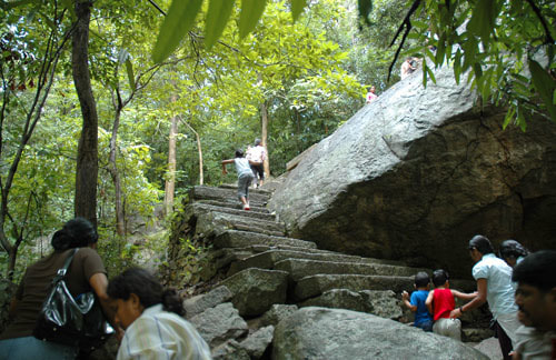
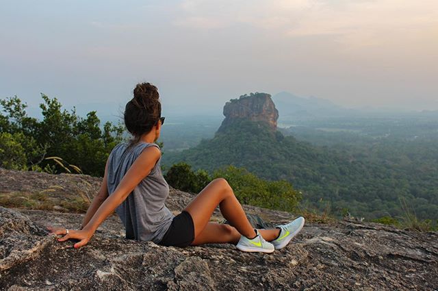
Pidurangala
A massive rock formation almost directly opposite Sigiriya, Pidurangala has an equally majestic view as the former of rolling lake-and-land vistas. Short of viewing it through drone footage, the summit of Pidurangala is also the best possible place to get an eyeful the rock fortress itself. It's not merely all about stunning views though: Pidu isn't just another nameless rock, it has its own little history and backstories. Other than just being a climbable rock which is nearly the same height as Sigiriya, Pidurangala was also a meditative retreat for monks. The hill is peppered with caves and little cells which were allegedly used by them. It's said that when King Kasyapa built the Sigiriya rock fortress, he relocated the monks there to Pidurangala, and then refurbished and expanded the monastery under his patronage.
|
|
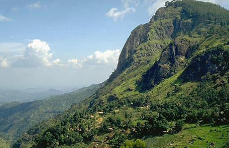
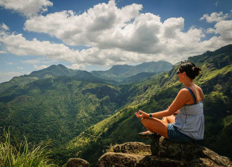
Ella Rock
Ella Rock is one of the must-sees in Ella, a place which is becoming increasingly touristy and even brands itself as a 'tourist town' (check out the signboards at the junction!). Offering panoramic views of the Ella Gap and Little Adam's Peak, the hike is an arduous upward climb and you're guaranteed to lose yourselves among tea estates, hills, and tall shrubs if you're with a guide. Sunrises over mountains (especially the ones in Ella) are nothing short of stunning: so we recommend a super early start to your day. There are a few trees photobombing the view especially the lone pine tree which you can pick out from Ella town, making Ella rock easily identifiable, but it's alright. The rock perches right at the edge, but it's quite comfortable and spacious so you can stretch out and enjoy the view.
|
|
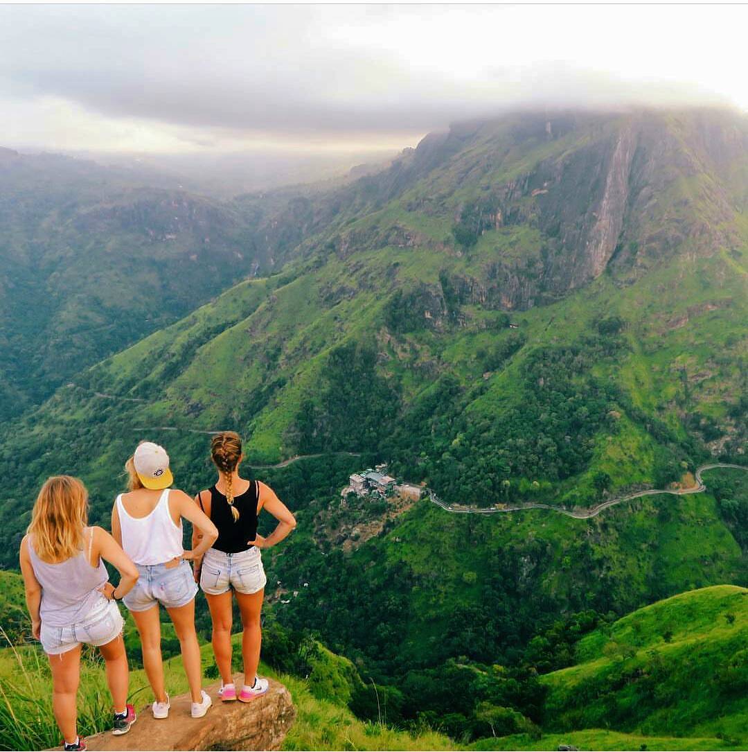
Little Adam's Peak
Don’t defiance the beautiful tourism site in Sri Lanka, Little Adams Peak whether considering the word ‘Little’,it is named after the sacred Adams Peak (Sri Pada –where the foot print of Lord Buddha is preserved) regarding the similarity between the two mountains. Therefore the mountain was called as Little Adams Peak.
“Punchi Sri Pada” is another name for this peak. It is 1141 m in height. Little Adam’s Peak attracts many travelers who come to Sri Lanka. Gradually with an easy hike up to the mountain of Little Adams Peak you can consummation a worth panoramic view. You have to walk through lush green tea plantations, waterfalls and paddy fields while enjoying the sceneries. It will be priceless if you could visit the place in the morning when the clouds roll in. Further places like Little Adams Peak deliberates ‘How far Sri Lanka is worth and rich with beautiful natural destinations of Sri Lankan tourism’. It will feel like a neck exercise for the visitors as you have to rotate your body to seek the views outstanding for 360 degrees. You could see the people who are plucking and collecting tea leaves, working in their estates. It will take around 35-45 min to reach to the top of the mountain on a zig- zag path. Thus it is an ideal place to watch sun rise in the morning. With prodigious views of as far as Ella rock and down to the gap will be gorgeous. |
|
Bible rock - Bathalegala
You don’t always get the opportunity to view the famous Bible Rock, or Bathalegala, from a very unusual angle. Usually we see it from far – a somber square sentinel in the distant mountainous horizon, looming over other rock and mountain, on our way up or down the Kadugannawa Pass along the Kandy Road. It is a distinguishing feature of that scenery, rising 2,618 feet above sea level and considered a delightful landmark which has challenged painter, poet and photographer from time immemorial. It was during the British Period that this rock was named Bible Rock, as its appearance is quite akin to an open book when viewed from the Kandy Road, which the British built. We were traveling along the scenic Hathgampola Road after turning off from Mawanella. At first, we were not sure what this rock was, that kept looming from time to time, dominating the surrounding planes, for we were quite foreign to the area and were in pursuit of, all together, another attraction.
|
|
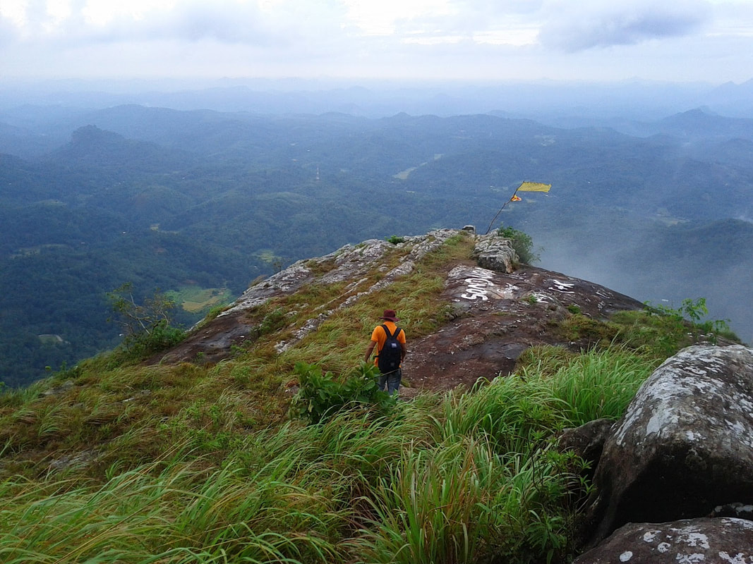
Wangedigala
Wangedigala mountain is located in a beautiful village called Kalupahana. The name Wangedigala is the Sinhala (Language) name for “Pestle”. It is given the name Wangedigala (Pestle) because the top of the mountain looks like a Pestle. This Mountain are two different peaks where most locals and as well as Tourist hikers consider as the same peak. Wangedigala is a rock platform on the left side of the mountain that resembles a stage area and offers exquisite view of the surrounding area. Hiking through the Pine forest of Wangedigala, hikers will experience the beauty of mountain ranges around them and breathtaking sceneries of Bambarakanda Fall and Lanka Fall which are falling from the neighbour mountain of Wangedigala. Hikers will get to cross Bambarakanda Falls from a rope bridge which will also be an exciting experience. While enjoying the terrains of mountain Wangedigala, hikers will require to climb on steep mountain slopes covered with Pine needles. Extra care should be exercised as this can become slippery when dry.
|
